

GeoBackground
is an option that specifies the background style of a GeoGraphics object.
Details
- The geo background of a GeoGraphics[prims,…] output is the actual map that appears underneath the primitives prims. A map like GeoGraphics[{},…] with no primitives will only show the geo background, and possibly auxiliary elements like geo grid lines or a scale bar.
- GeoBackground values can be given as GeoBackgroundGeoStyling[mapstyle] for any valid GeoStyling map style. For named map styles, such as "ReliefMap" or "Satellite", GeoBackgroundGeoStyling["mapstyle"] may also be specified as GeoBackground"mapstyle".
- GeoBackground map styles may be given by vector data (graphics primitives) or by raster data (images).
- GeoBackgroundAutomatic or GeoBackground"Default" are equivalent to GeoBackground"Terrain".
- Vector map styles include:
-
"Basic" bright, modern look for business presentations 
"BlackWhite" black and white map 
"Classic" "StreetMap"-like style 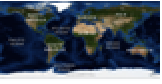
"Monochrome" gray-level design for printing and accessibility 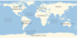
"Plain" simplified map representation 
"Terrain" "Basic" style with satellite imagery for land - These vector styles have light and dark versions depending on the notebook light-dark mode at evaluation time. The light version of "Basic" can be obtained with "BasicLight" and its dark version with "BasicDark", and similarly for the other vector styles.
- Other vector map styles include:
-
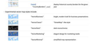
"VectorBusiness" bright, modern look for business presentations 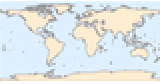
"VectorDark" dark monochrome 
"VectorMinimal" simplified map representation 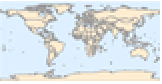
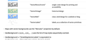
"VectorMonochrome" single-color design for printing and accessibility 
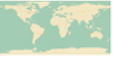
"VectorVintage" historical design 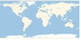
"VectorWeb" clean, bold design for a website or blog 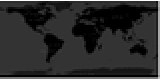
"VectorLabels" labels, as a collection of vector primitives - All vector styles have a version without labels. For example "BasicNoLabels" is the version without labels of "Basic", and similarly for other vector styles.
- Possible vector outline map styles include:
-
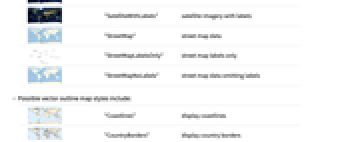
"Coastlines" display coastlines 
"CountryBorders" display country borders 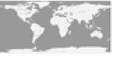
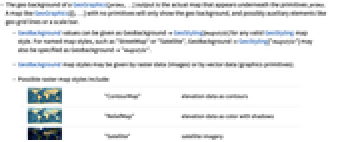
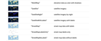
Dated["CountryBorders",year] display historical country borders for the given year - Possible raster map styles include:
-
"ContourMap" elevation data as contours 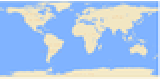
"ReliefMap" elevation data as color with shadows 
"Satellite" satellite imagery 
"SatelliteNight" satellite imagery by night 
"SatelliteWithLabels" satellite imagery with labels 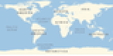
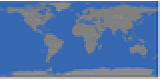
"StreetMap" street map data with labels 
"StreetMapLabelsOnly" street map labels only 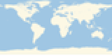
"StreetMapNoLabels" street map data without labels 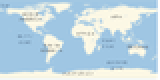
"StreetMapVectorLabels" street map with vector labels overlaid - GeoBackground{style1,style2,…} uses the list of map styles sequentially overlaid.
- GeoBackground"StreetMapVectorLabels" is equivalent to GeoBackground{"StreetMapNoLabels","VectorLabels"}.
- GeoBackgroundNone specifies that no geo background should be used, meaning no background regions are displayed.
- GeoBackgroundGeoStyling[image] places image as the geo background, stretching it to cover the map.
- GeoBackgroundGeoStyling[{"Image",image,"Projection"proj,"Bounds"bounds}] specifies that the image is given in projection proj and covers the given bounds in projected space.
- GeoBackground takes precedence over Background in geo graphics.
Examples
open all close allBasic Examples (3)
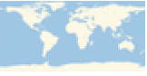
Display with the default GeoBackground:
Scope (14)
Display with the default GeoBackground:
Explicitly specify an automatic GeoBackground:
Use satellite imagery as background:
Use satellite imagery from an external tile provider:
Use vector map styles as geo background:
Use the light and dark versions of the default map of the world:
Use the versions with and without labels of the "Plain" map of Australia:
Show country borders in the geo background:
Show country borders in the year 1800 for the region corresponding to modern Italy:
Overlay several geo background map styles:
Specify parameters for one of the styles:
Control the geo zoom level independently for several geo background styles:
Use GeoBackground to display a relief for all regions that lie within the bounding box of the given primitive:
Display that image as geo background, partially visible behind the map:
Specify a region of the map for the geo background image using projected coordinates:
GeoBackgroundGeoStyling[{"GeoImage",image}] specifies that the image was given in latitude-longitude space, and therefore will be transformed to the map projection:
GeoBackground applies to the geographic map, and Background to the whole graphic:
Possible Issues (3)
Specifying None as a geo background is not the same as specifying GeoStyling[None]:
Specifying Automatic as a geo background is not the same as specifying GeoStyling[Automatic]:
Specifying "OutlineMap" as geo background sets the style of the whole geo background polygon:
Use "Coastlines" or "CountryBorders" to include an actual map in the geo background:
Text
Wolfram Research (2014), GeoBackground, Wolfram Language function, https://reference.wolfram.com/language/ref/GeoBackground.html (updated 2025).
CMS
Wolfram Language. 2014. "GeoBackground." Wolfram Language & System Documentation Center. Wolfram Research. Last Modified 2025. https://reference.wolfram.com/language/ref/GeoBackground.html.
APA
Wolfram Language. (2014). GeoBackground. Wolfram Language & System Documentation Center. Retrieved from https://reference.wolfram.com/language/ref/GeoBackground.html