GeoGridRange


GeoGridRange
is an option for geographic functions that specifies the range of projected coordinates to include.
Details
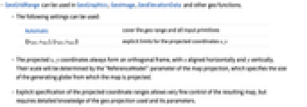
- GeoGridRange can be used in GeoGraphics, GeoImage, GeoElevationData and other geo functions.
- The following settings can be used:
-
Automatic cover the geo range and all input primitives {{xmin,xmax},{ymin,ymax}} explicit limits for the projected coordinates x,y - The projected x,y coordinates always form an orthogonal frame, with x aligned horizontally and y vertically. Their scale will be determined by the "ReferenceModel" parameter of the map projection, which specifies the size of the generating globe from which the map is projected.
- Explicit specification of the projected coordinate ranges allows very fine control of the resulting map, but requires detailed knowledge of the geo projection used and its parameters.
Examples
open all close allBasic Examples (2)
Scope (2)
Properties & Relations (1)
GeoRange defines the part of the Earth to be projected:
GeoGridRange selects a part of that map in the projected coordinates:
Wolfram Research (2019), GeoGridRange, Wolfram Language function, https://reference.wolfram.com/language/ref/GeoGridRange.html.
Text
Wolfram Research (2019), GeoGridRange, Wolfram Language function, https://reference.wolfram.com/language/ref/GeoGridRange.html.
CMS
Wolfram Language. 2019. "GeoGridRange." Wolfram Language & System Documentation Center. Wolfram Research. https://reference.wolfram.com/language/ref/GeoGridRange.html.
APA
Wolfram Language. (2019). GeoGridRange. Wolfram Language & System Documentation Center. Retrieved from https://reference.wolfram.com/language/ref/GeoGridRange.html