GeoIdentify
✖
GeoIdentify
詳細とオプション


- GeoIdentifyは,拡張された地理的な地域を表すEntityオブジェクトのリストを返す.
- GeoIdentify[enttype,loc]の loc は,GeoPositionオブジェクト,"City","Country"あるいは"HistoricalCountry"のような領域の地理実体,Dated[…]オブジェクト,GeoVariant[…]式等を含む任意の地理的位置オブジェクトでよい.
- GeoIdentify[enttype,loc]の enttype は,Entity["Country"]のようなEntityオブジェクトあるいは"City"のような文字列として指定できる.
- enttype に有効な形式
-
"Country" 国,領土等 "City" 都市 "AdministrativeDivision" 任意レベルの行政部門 "AdministrativeDivision1" トップレベル行政部門 "AdministrativeDivision2" 第2レベル行政部門 "AdministrativeDivision3" 第3レベル行政部門 "HistoricalCountry" 歴史的な国,領域,帝国等 "MilitaryConflict" 軍事衝突 "Ocean" 海洋 "USCounty" アメリカの郡 "USState" アメリカの州 "ZIPCode" アメリカの郵便番号 Dated[ent,date] date における enttype タイプの実体 GeoVariant[enttype,variant] variant 領域を使った実体 EntityClass["type","class"] class の個別の成員 enttype1enttype2… enttypeiのいずれか All 任意の可能なタイプ - 場所 loc は,GeoPosition,Entityオブジェクト,GeoGraphicsプリミティブのいずれかとして指定できる.
- GeoIdentify[]およびGeoIdentify[regtype]では,場所は,$GeoLocationの現行設定であるとみなされる.
例題
すべて開くすべて閉じる例 (4)基本的な使用例
https://wolfram.com/xid/01y9by58p24-8ss30m
https://wolfram.com/xid/01y9by58p24-7c6iyy
https://wolfram.com/xid/01y9by58p24-v37hy4
GeoPosition[{42.11`,-89.24`}]の州と郵便番号:
https://wolfram.com/xid/01y9by58p24-pplzvs
https://wolfram.com/xid/01y9by58p24-9qbt5p

スコープ (10)標準的な使用例のスコープの概要
地理データ (6)
https://wolfram.com/xid/01y9by58p24-sle34n

https://wolfram.com/xid/01y9by58p24-jwzw9a
https://wolfram.com/xid/01y9by58p24-bk7lqy
https://wolfram.com/xid/01y9by58p24-pzd0vh
https://wolfram.com/xid/01y9by58p24-ww3nar

https://wolfram.com/xid/01y9by58p24-j2xpyx
https://wolfram.com/xid/01y9by58p24-rw4th8

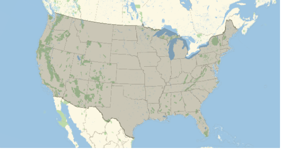
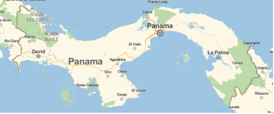
ユーザの現在地が,該当する場合は,NAFTA諸国のどの国にあるかを調べる:
https://wolfram.com/xid/01y9by58p24-dgq9oj
https://wolfram.com/xid/01y9by58p24-8ejtro
https://wolfram.com/xid/01y9by58p24-66em5x

歴史データ (4)
https://wolfram.com/xid/01y9by58p24-1bspd3
Datedを実体タイプと一緒に使うと空間的にオーバーラップする日付を指定した結果が返される:
https://wolfram.com/xid/01y9by58p24-chl4gc
歴史的ではない実体と歴史的実体タイプを使うと,日付情報を無視してオーバーラップが計算される:
https://wolfram.com/xid/01y9by58p24-l5s6yz

Datedを実体と一緒に使って指定の日付範囲に検索を制限する:
https://wolfram.com/xid/01y9by58p24-t2j9fx
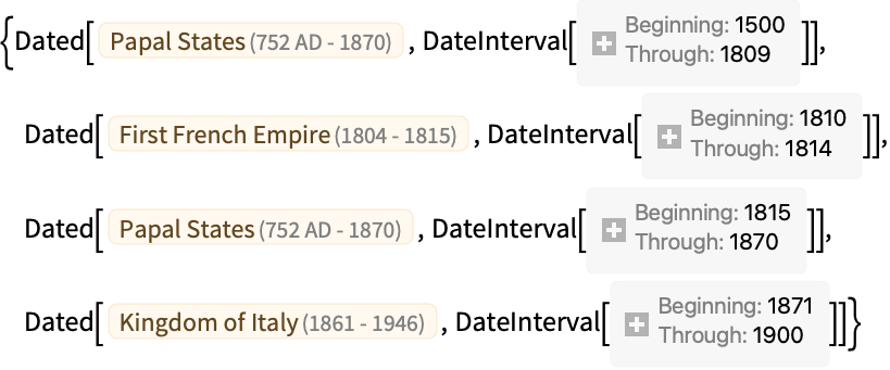
Datedを実体タイプと一緒に使って指定の日付範囲に検索を制限し,オーバーラップした期間を取得する:
https://wolfram.com/xid/01y9by58p24-57gawe

指定の日付に指定の地理的位置を含んでいた歴史上の実体を特定する:
https://wolfram.com/xid/01y9by58p24-llc475
オプション (1)各オプションの一般的な値と機能
"FullyContained" (1)
デフォルトで,場所の一部をカバーする実体はその場所を含むとみなされる:
https://wolfram.com/xid/01y9by58p24-qzja5u
オプション"FullyContained"->Trueを使うと,その場所の一部しか含まない実体は除外される:
https://wolfram.com/xid/01y9by58p24-ql8tnf
アプリケーション (1)この関数で解くことのできる問題の例
特性と関係 (3)この関数の特性および他の関数との関係
GeoIdentifyは常にリストを返す:
https://wolfram.com/xid/01y9by58p24-1yg53l
https://wolfram.com/xid/01y9by58p24-ir5va5
場所のクエリが拡張地域に当る場合は,それを含む複数の実体がある場合がある:
https://wolfram.com/xid/01y9by58p24-j3vw19

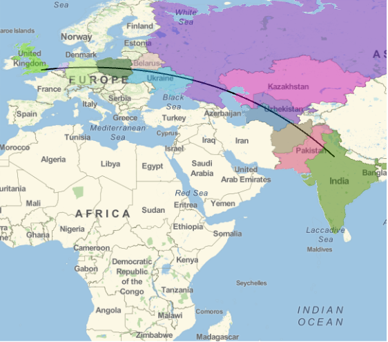
拡張された場所 loc については,GeoIdentify[enttype,loc]は,事実上,GeoEntities[loc,enttype]と同等である:

https://wolfram.com/xid/01y9by58p24-yuwv4j
Wolfram Research (2014), GeoIdentify, Wolfram言語関数, https://reference.wolfram.com/language/ref/GeoIdentify.html (2024年に更新).テキスト
Wolfram Research (2014), GeoIdentify, Wolfram言語関数, https://reference.wolfram.com/language/ref/GeoIdentify.html (2024年に更新).
Wolfram Research (2014), GeoIdentify, Wolfram言語関数, https://reference.wolfram.com/language/ref/GeoIdentify.html (2024年に更新).CMS
Wolfram Language. 2014. "GeoIdentify." Wolfram Language & System Documentation Center. Wolfram Research. Last Modified 2024. https://reference.wolfram.com/language/ref/GeoIdentify.html.
Wolfram Language. 2014. "GeoIdentify." Wolfram Language & System Documentation Center. Wolfram Research. Last Modified 2024. https://reference.wolfram.com/language/ref/GeoIdentify.html.APA
Wolfram Language. (2014). GeoIdentify. Wolfram Language & System Documentation Center. Retrieved from https://reference.wolfram.com/language/ref/GeoIdentify.html
Wolfram Language. (2014). GeoIdentify. Wolfram Language & System Documentation Center. Retrieved from https://reference.wolfram.com/language/ref/GeoIdentify.htmlBibTeX
@misc{reference.wolfram_2025_geoidentify, author="Wolfram Research", title="{GeoIdentify}", year="2024", howpublished="\url{https://reference.wolfram.com/language/ref/GeoIdentify.html}", note=[Accessed: 04-April-2025
]}
BibLaTeX
@online{reference.wolfram_2025_geoidentify, organization={Wolfram Research}, title={GeoIdentify}, year={2024}, url={https://reference.wolfram.com/language/ref/GeoIdentify.html}, note=[Accessed: 04-April-2025
]}

