GeoVectorPlot
GeoVectorPlot[vecs]
根据地理向量 vecs 的场生成向量图.
GeoVectorPlot[{vecs1,vecs2,…}]
分别为每个 vecsi 生成向量图.
更多信息和选项


- GeoVectorPlot 用箭头或其他离散的标记绘制地理区域上的向量场的方向和幅值.
- 可用以下形式给出向量集合 vecs:
-
GeoVector[…],GeoVectorENU[…],… 组合地理向量 {vec1,vec2,…} 个别地理向量的列表 <loc1vec1,loc2vec2,…> 位置和向量组成的关联 - 可用以下形式给出地理位置 loci:
-
GeoPosition[{lat,lon}] 经度和纬度 Entity[…] 地理实体 Dated[ent,date] 有日期的实体 - 可用以下形式给出向量 veci:
-
GeoVector[{m,α}] posi 处幅值为 m、方向为 α 的向量 GeoVectorENU[{ve,vn}] 具有东向和北向分量的向量 - 绘制向量图时将忽略不是以这些形式给出的数据.
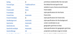
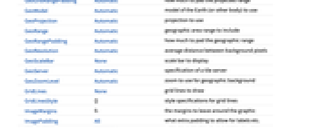
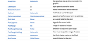
- GeoVectorPlot 与 GeoGraphics 有同样的选项,不同之处及更多选项如下所示: [所有选项的列表]
-
ClippingStyle Automatic 如何显示向量范围之外的箭头 Method Automatic 绘图时使用的方法 PerformanceGoal $PerformanceGoal 优化的目标 PlotLegends None 向量场的图例 PlotTheme $PlotTheme 绘图的整体外观主题 RegionBoundaryStyle Automatic 如何设置绘图区域边界的样式 RegionFillingStyle Automatic 如何设置绘图区域内部的样式 RegionFunction True 确定要包含的范围 VectorAspectRatio Automatic 箭头的宽长比 VectorColorFunction Automatic 如何为向量着色 VectorColorFunctionScaling True 是否缩放传递给 VectorColorFunction 的参数 VectorMarkers Automatic 向量的形状 VectorPoints Automatic 向量的数量或如何放置向量 VectorRange Automatic 要显示的向量长度的范围 VectorScaling None 如何缩放箭头的大小 VectorSizes Automatic 显示出来的箭头的大小 VectorStyle Automatic 如何绘制向量 - 提供给 RegionFunction 的参数有 lat、lon、vlat、vlon、Norm[vec].
- RegionFunction->region 中 region 的值可为实体或地理多边形.
- VectorPoints 和 StreamPoints 接受地理位置和实体集合.
所有选项的列表


范例
打开所有单元关闭所有单元范围 (20)
数据 (11)
用 GeoVector 表示一组模为 m、方向为 α 的向量:
用 GeoVector 表示相应位置上一组模为 m、方向为 α 的向量:
用 GeoVectorENU 表示一组向量:
用 QuantityArray 表示由数量向量组成的数组:
演示 (9)
使用以伊利诺伊州香槟市为中心的 Albers GeoProjection:
选项 (48)
GeoCenter (3)
GeoGridLines (1)
GeoRange (1)
用 GeoRange 定义经纬坐标范围:
GeoRangePadding (1)
GeoServer (1)
默认情况下,GeoVectorPlot 从 Wolfram GeoServer 下载地理背景图块:
GeoZoomLevel (1)
在默认 GeoZoomLevel 的纽约市地图上显示风向:
RegionFunction (2)
VectorMarkers (6)
VectorPoints (7)
VectorStyle (3)
VectorColorFunction 比 VectorStyle 中的颜色的优先级高:
设置 VectorColorFunctionNone,用 VectorStyle 指定颜色:
属性和关系 (13)
GeoStreamPlot 根据向量场生成流线图:
通过 GeoBubbleChart 用成比例的气泡显示值:
通过 GeoRegionValuePlot 用着色区域显示值:
用 GeoHistogram 将位置汇集为箱:
用 GeoSmoothHistogram 根据位置生成平滑密度图:
用 GeoListPlot 绘制个别位置:
用 GeoContourPlot 在地图中绘制等高线:
用 GeoDensityPlot 和颜色对地图进行平滑着色:
用 ListVectorPlot 或 ListStreamPlot f绘制一般数据:
使用 ListVectorDensityPlot 或 ListStreamDensityPlot 包含标量场的密度图:
用 VectorDisplacementPlot 可视化位移场的效果:
使用 ListVectorPlot3D 和 ListStreamPlot3D 可视化三维向量场数据:
文本
Wolfram Research (2019),GeoVectorPlot,Wolfram 语言函数,https://reference.wolfram.com/language/ref/GeoVectorPlot.html (更新于 2020 年).
CMS
Wolfram 语言. 2019. "GeoVectorPlot." Wolfram 语言与系统参考资料中心. Wolfram Research. 最新版本 2020. https://reference.wolfram.com/language/ref/GeoVectorPlot.html.
APA
Wolfram 语言. (2019). GeoVectorPlot. Wolfram 语言与系统参考资料中心. 追溯自 https://reference.wolfram.com/language/ref/GeoVectorPlot.html 年